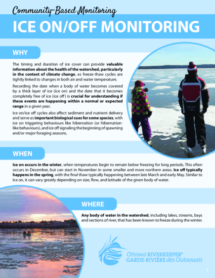
Ice On/Off Observations
We keep track of observations of Ice On and Ice Off throughout the watershed from the Riverwatch network and the general public. These observations help us track seasonal changes over time.
In short, ice on is the date when a body of water is fully covered by a layer of ice thick enough to stand on, and ice off is the date when that body of water becomes completely free of ice. Timing and duration of ice cover can provide valuable information about the health of the watershed, particularly in the context of climate change, as freeze-thaw cycles are tightly linked to changes in both air and water temperature.
Ice on/ice off cycles also affect sediment and nutrient delivery and serve as important biological cues for some species, with ice on triggering behaviours like hibernation (or hibernation-like behaviours), and ice off signaling the beginning of spawning and/or major foraging seasons.
Unfortunately, data is scarce for ice on/ice off in the Ottawa River Watershed, likely in part due to the fact that it can vary significantly depending on the area of the watershed. Some areas freeze as soon as temperatures drop, others never freeze, and some can even freeze and thaw multiple times in a single winter. With an area larger than England, it’s hard to get the whole story about ice on/off in the watershed without a little help. That’s where you come in!
Since the appearance and disappearance of ice on the surface of the water can often be determined by a simple visual observation that does not require special equipment or training, ice on/ice off has the potential to be very well-documented through citizen science. If you live near water (lake, stream, tributary, or section of the main stem) that has been known to freeze during the winter, we want to hear from you! In the fall/winter when ice forms, and in the spring when it melts, let us know what dates these events occur. For areas that freeze and thaw multiple times before remaining frozen, please report both the first date of ice on conditions and the date those conditions appeared and remained. Similarly, areas that refreeze in the spring after ice off conditions have occurred, please report the dates of the first and final thaws.
Use our guide to learn how to identify ice on and ice off.
Ice-off community observations:
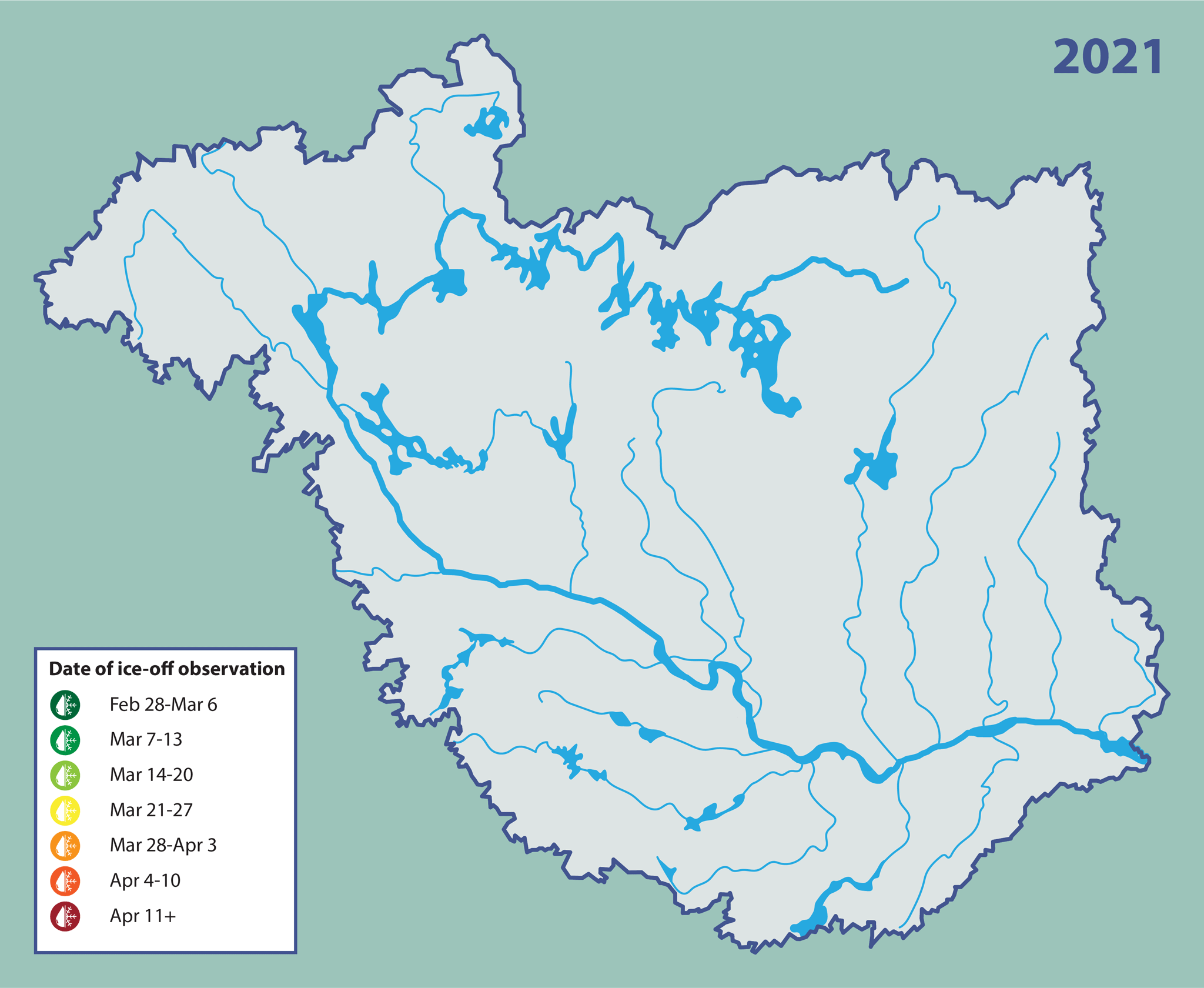
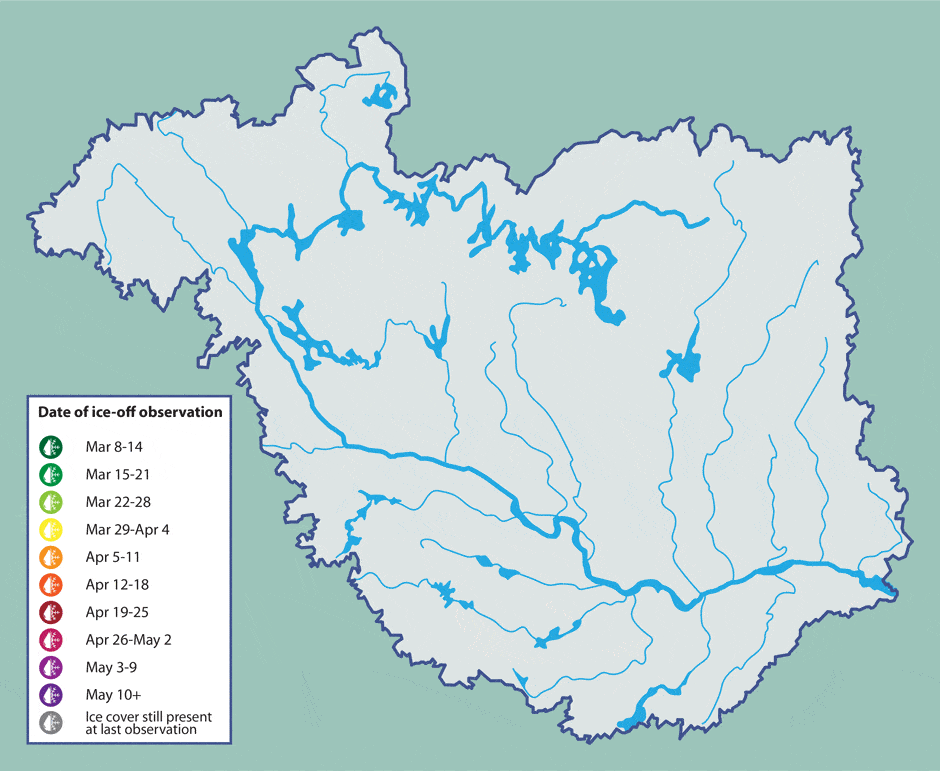
Last updated: May 10th 2021
We’ve been asking you to let us know when you see ice off conditions in your part of the watershed, and so far we’ve received a ton of responses! This map shows when and where citizens of the watershed have sent us their observations, and will continue to be updated as new observations come in.
Grey markers identifying areas where there is still ice cover are based on the most recent observation that we have received for that location, so if you live near one of those areas and notice ice off conditions, let us know! Or, if you live in an area without any observations marked on this map, send us yours (ice on or off) so we can keep this map as up-to-date and complete as possible.
Submit an observation:
Please include the location, GPS coordinates, as well as a picture, and weather conditions for that day if possible. We will add your observations to our map, so you, and the rest of the watershed, can see how ice cover changes over time throughout the watershed. In addition, we will add your submissions to IceWatch, a national database of ice conditions, whose guidelines we use to set our ice on/off definitions.
Further resources:
