Posted: September 30, 2025
Mapping Populations of Invasive Species: Why Early Detection Matters
A new program with Ottawa Riverkeeper is trying to better understand the invasive species reports we have received in the watershed. A recent report of European water chestnut in the southern part of the Ottawa River underscores the importance of being able to map the presence and distribution of these species. While this isn’t something we celebrate, it clearly highlights why early detection is critical to limiting the spread of invasive species.
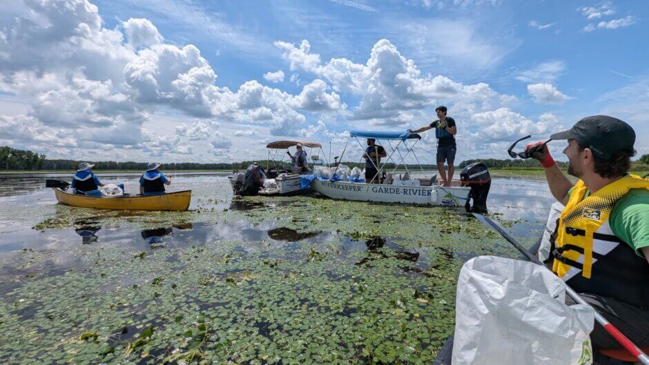
This summer, Ottawa Riverkeeper launched a new program to map populations of invasive species that have been previously reported through our Invasive Species Monitoring Program. These reports provided us with information about the presence of invasive species in a given area, but did not provide details on the magnitude of spread. We were left wondering:
- Are previously reported invasive species still present?
- Have they become established?
- If so, how much have they spread in a given area?
By gathering data and answering these questions, we are learning valuable information about the extent of invasive species in the watershed with the hopes of identifying locations suitable for invasive species removal programs, improving signage near boat ramps, and promoting outreach about species found in various locations. This additional data will provide valuable insight into the presence and spread of invasive species throughout the watershed, allowing for more targeted and effective prevention and management.
Mapping Invasive Species: A Coordinated Response
Earlier this summer, we learned that European water chestnut may be present in the southern section of the Ottawa River. During a conversation with South Nation Conservation Authority, we heard concerns that this fast-growing, invasive aquatic plant might be spreading undetected near Clarence-Rockland, Ontario. Water chestnut had already established itself across the river near Thurso, Quebec, with a few smaller patches spotted upstream. Worried about the risk of further spread, Ottawa Riverkeeper decided to assess the situation.
Why are we concerned?
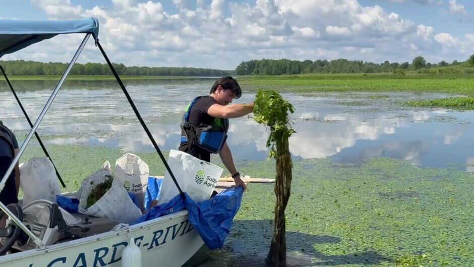
Once established, removing European water chestnut can be a difficult and time-consuming task due to its extensive root system. The plant can regrow from just a small fragment of the roots, even after removing the stem and leaves. You can read more about our experience removing water chestnut in Baie de Lochaber from a previous blog.
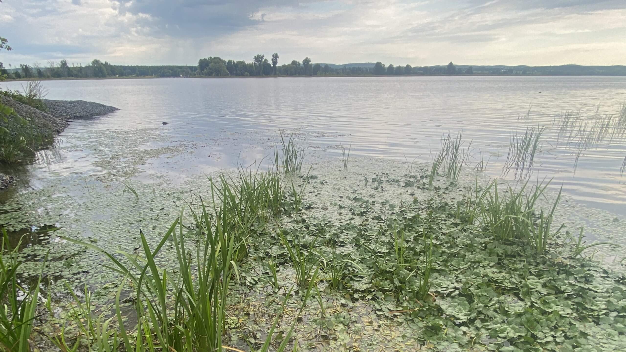
When visiting the area where the European water chestnut was reported, we discovered a significant patch, spanning nearly a square kilometre, with more than 50% of the water’s surface covered in foliage. Ottawa Riverkeeper immediately shared this information with South Nation Conservation, providing key details about the patch’s location, size, and density. With this information, the conservation authority can now make an informed decision on how to manage and/or remove this patch of European water chestnut before it spreads even further.
While it’s disheartening to find a new patch of water chestnut, identifying it early means removal is still feasible. With swift action, we are optimistic that it can be eradicated from the bay entirely! This entire situation highlights that the sooner invasive species are found, the better the chances are of controlling or eliminating them. The longer they go unnoticed, the more damage they can do and the harder they are to remove.
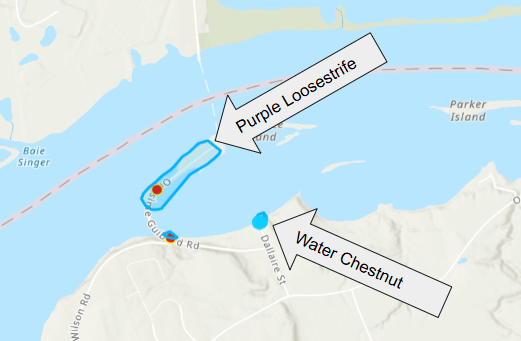
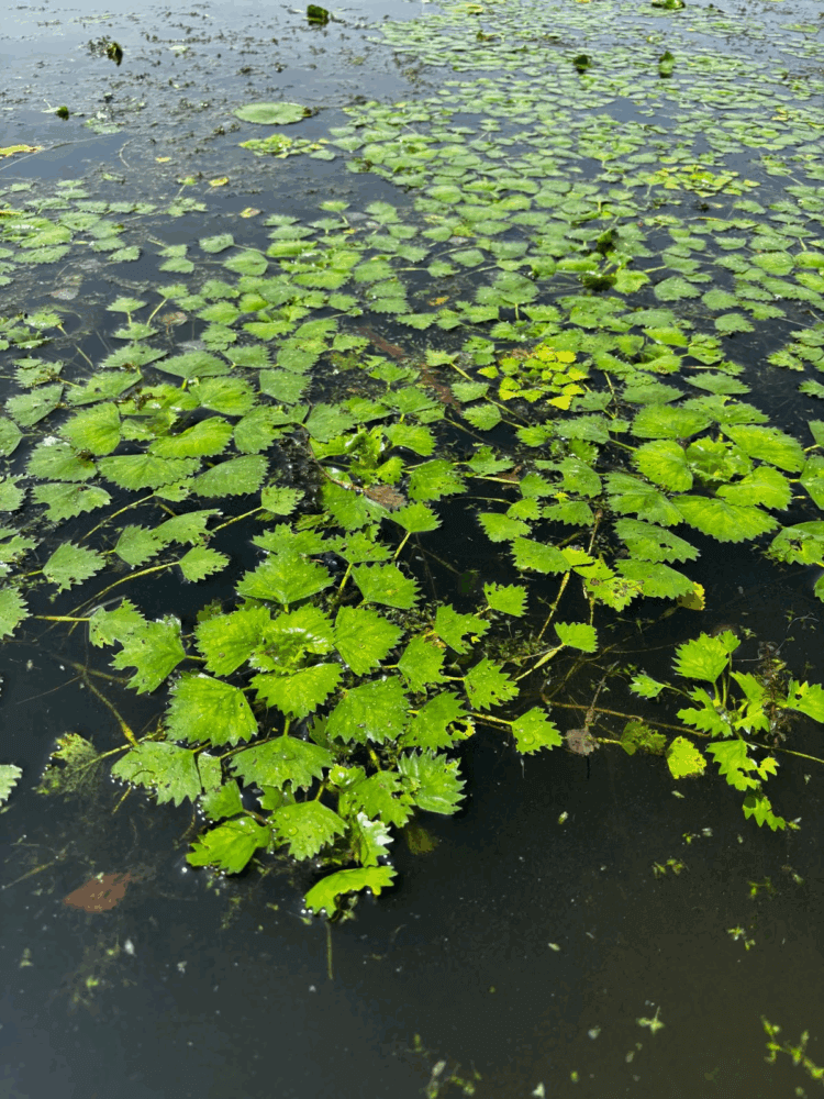
Mapping the distribution of invasive species. (Left) A location near Clarence, Ontario, where European water chestnut was mapped, in addition to several patches of invasive Purple Loosestrife. (Right) A close-up image of European water chestnut leaves on the river’s surface.
Mapping Invasive Species Throughout the Watershed
This early detection of water chestnut is a perfect illustration of what Ottawa Riverkeeper is hoping to accomplish through our new invasive species mapping initiative. This project focuses on mapping populations of invasive species that have been previously reported through our Invasive Species Monitoring Program. With the help of community scientists, Ottawa Riverkeeper staff have been using a mapping software to record important information about invasive species in our watershed.
Tracking the extent of invasive species in the watershed can kickstart and guide management actions, such as targeted removal efforts! The additional information gathered through this project will provide a much better understanding of the current state of populations of invasive species that have been historically reported across this vast watershed.
Reporting Invasive Species Sightings
If you would like to get involved, please contact Ottawa Riverkeeper’s Science Programs Coordinator (CBM@ottawariverkeeper.ca). By contributing to this project, you would play a meaningful role in the efforts to engage in more widespread invasive species monitoring.
You can contribute to understanding and monitoring invasive species in the Ottawa River watershed by learning to identify species with Ottawa Riverkeeper’s quizzes or reporting any of the 15 invasive species we monitor for on our website or on iNaturalist!
Funding for this project comes from

Leave a Reply